
Experience Masterplanning
Riyadh Complete Communities

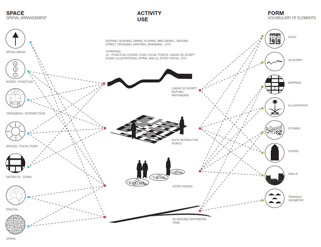
The underlying design Processes
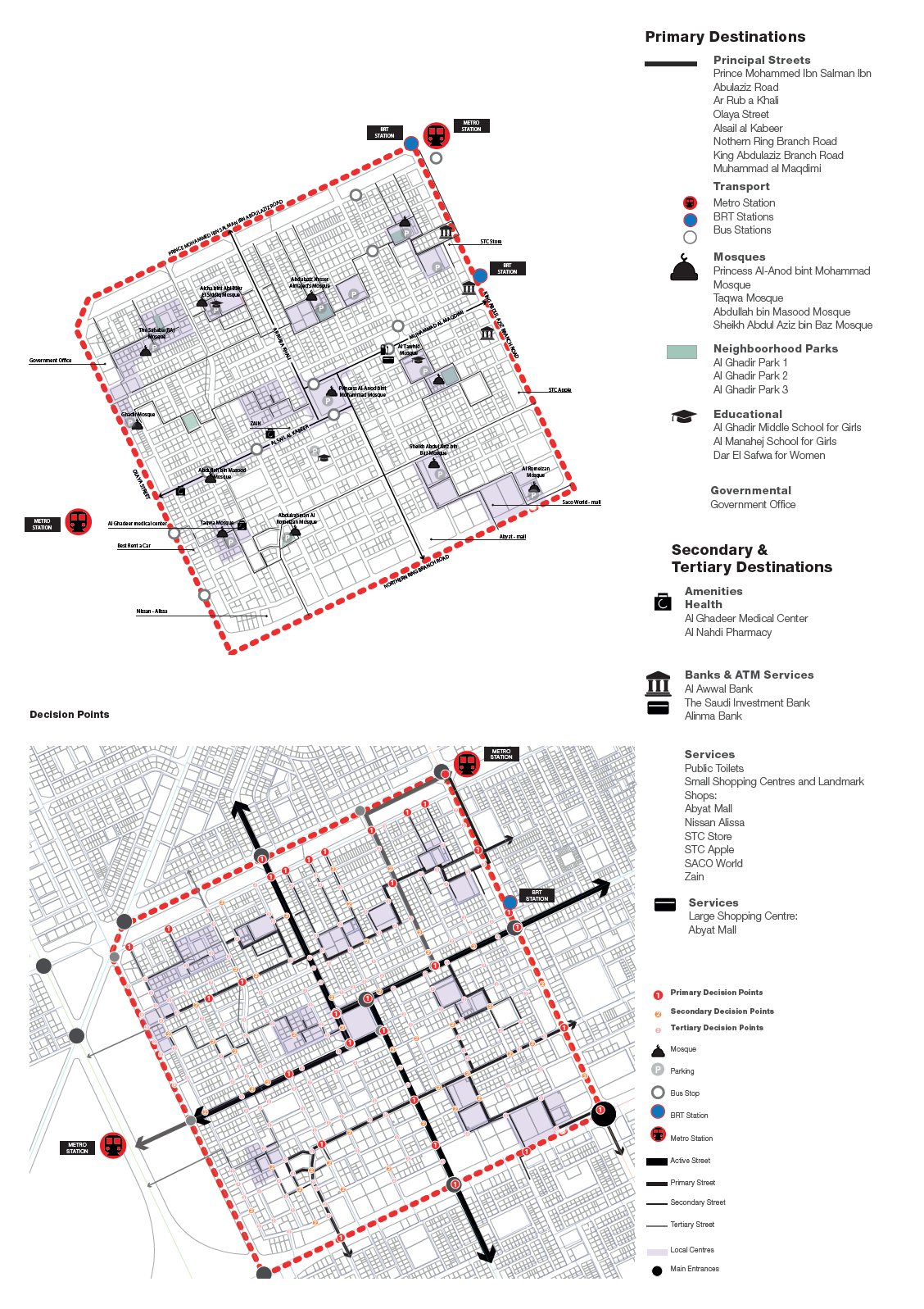
Guided primarily by the project spatial analysis, the strategy has been developed through continual collaboration and guidance provided by the technical project department; representatives from the design and planning, engineering and traffic management. The design analysis process is driven by;
- The visual integration analysis; is about ‘to’ movements and highlights neighbourhood centres, where people will congregate. It typically indicates how many people are likely to be in a space, and corresponds to rates of social encounter and retail activities. The integration analysis contributes to an understanding of areas of potential local centres, where there might be an increased footfall.
- Radius choice analysis; shows the route hierarchy for ‘through’ movement and highlights most traversed routes based on human behaviour to follow longest paths with least angular change and therefore longest sight lines.
- Decision Points; identifies areas of greater visibility, where more people tend to congregate. Based on the premise that people are more likely to hang-around areas and routes that are visibly integrated. It identifies and marks primary, secondary and tertiary points within a the neighbourhood.

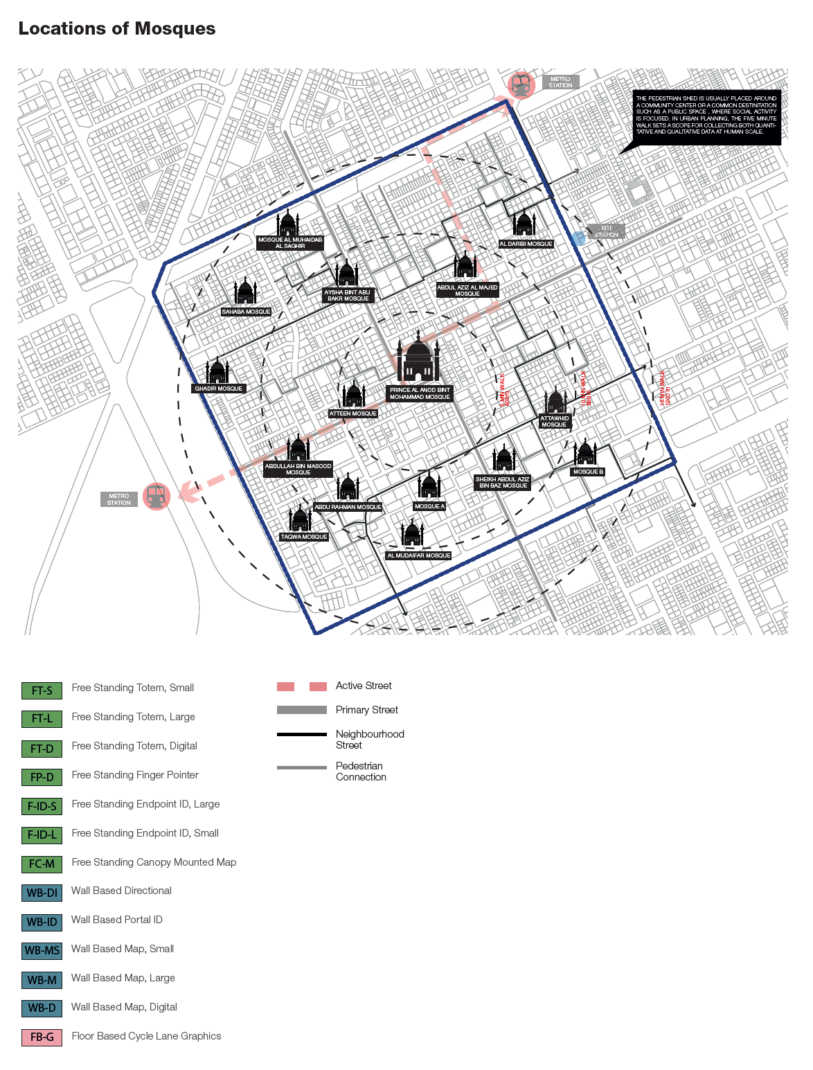
Signage family- Applications
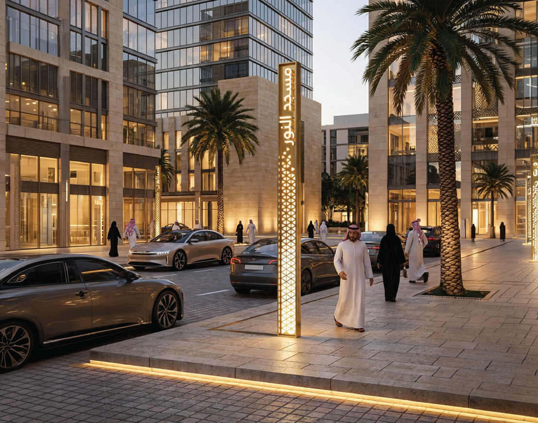
A bespoke design language for Riyadh
The signage and wayfinding design concept has been developed through a systematic spatial study that analyzes for opportunities, deficiencies and constraints. This information provides a gap analysis that formes the basis of this signage and wayfinding strategy that will mitigate directional challenges at both vehicular and pedestrian levels.
The resultant signage and wayfinding system will provide the directional identifty accross of Riyadh’s neighbourhoods, which addresses the needs of locals, visitors, occasional by-passers, and the visually and mobility challenged.
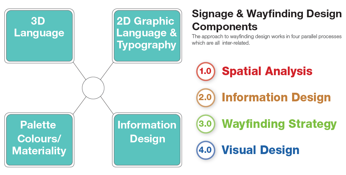
The signage and wayfinding design system is developed through a process of design components. The unique approach consists of four parallel processes that are interconnected and iterative. This design process maps the spatial conditions and identifies the opportunities to enhance the neighbourhoods through a well-designed signage and wayfinding system.
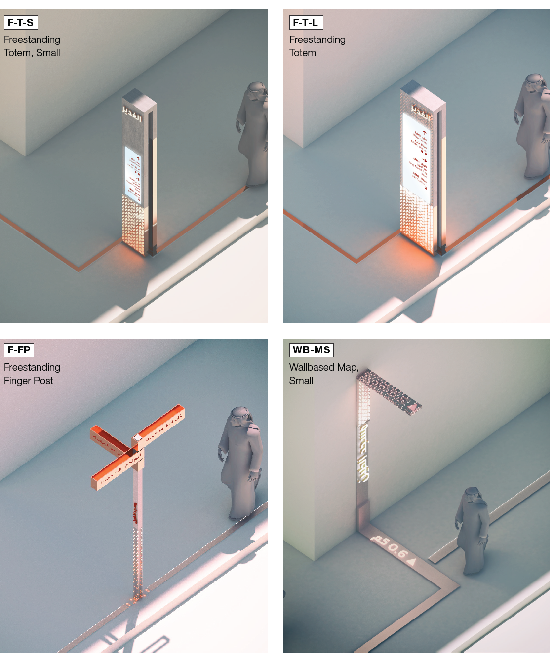
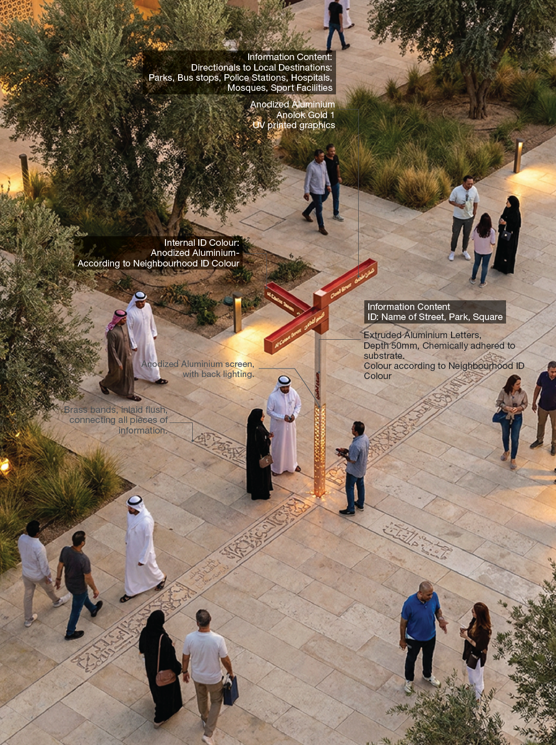
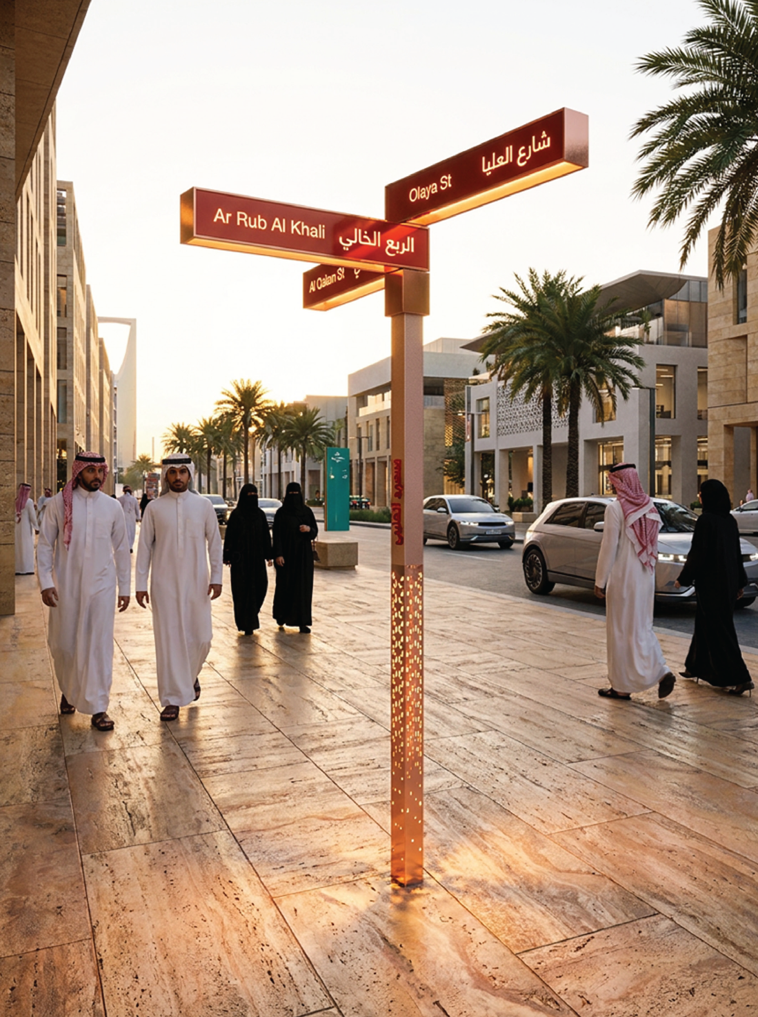
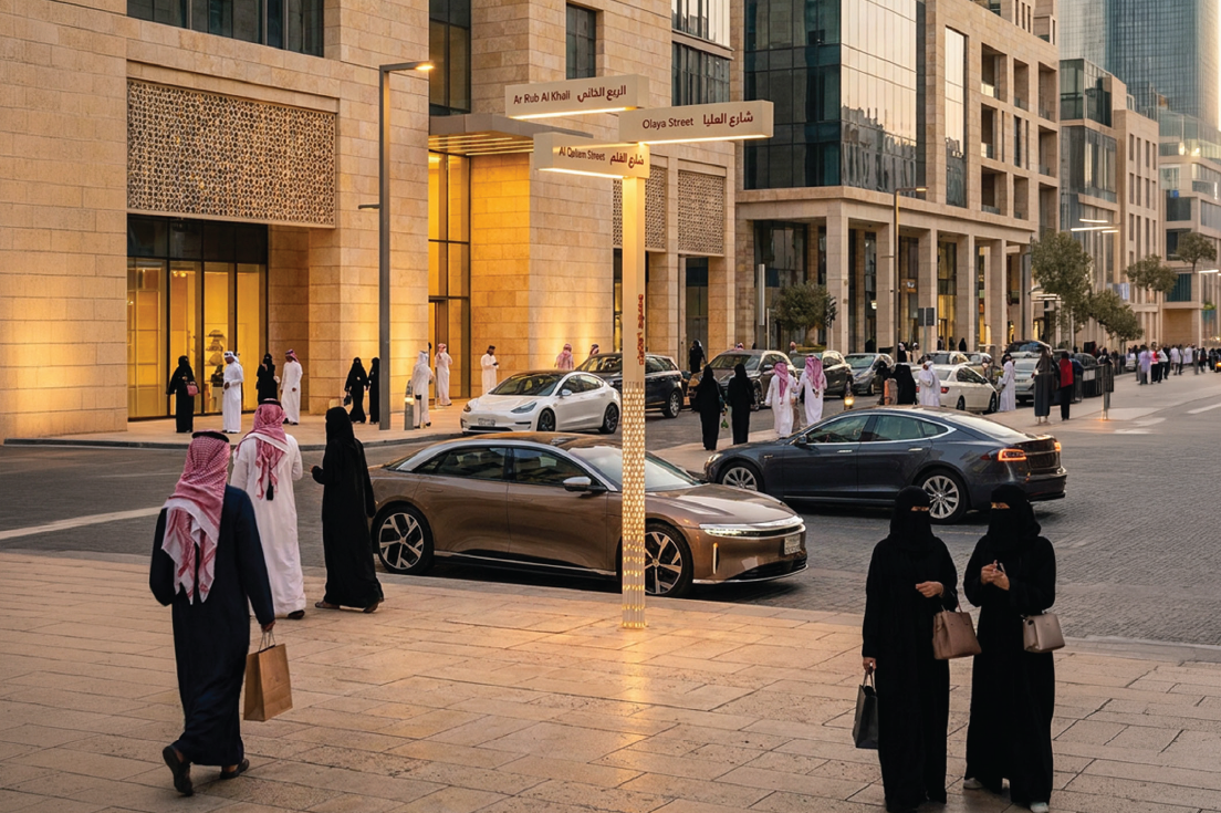
Finger Post
The digital freestanding finger post will be used at secondary and tertiary decision point where limited space on the sidewalk is available and the amount of information to be communicated is limited. Information will include directionals towards local points of interest.

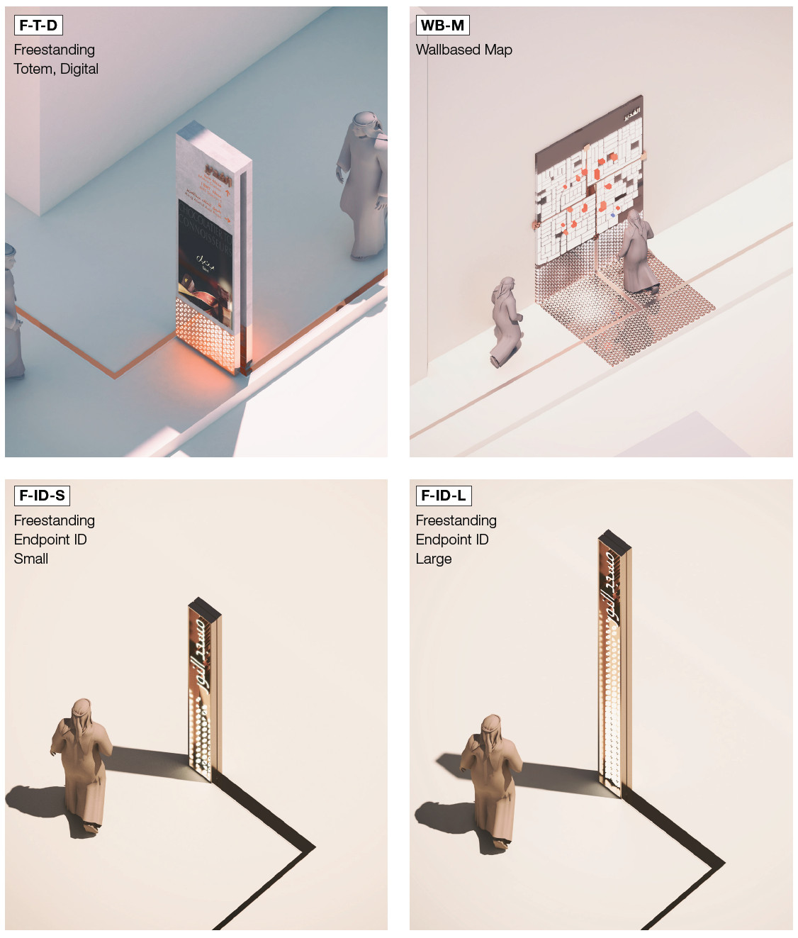
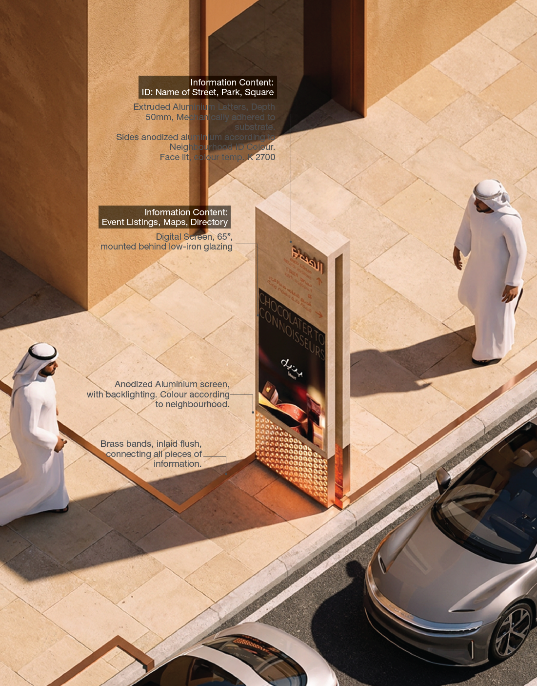
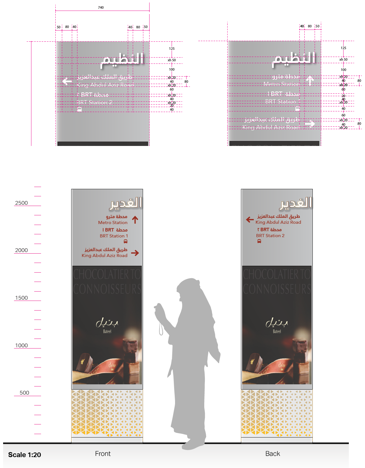
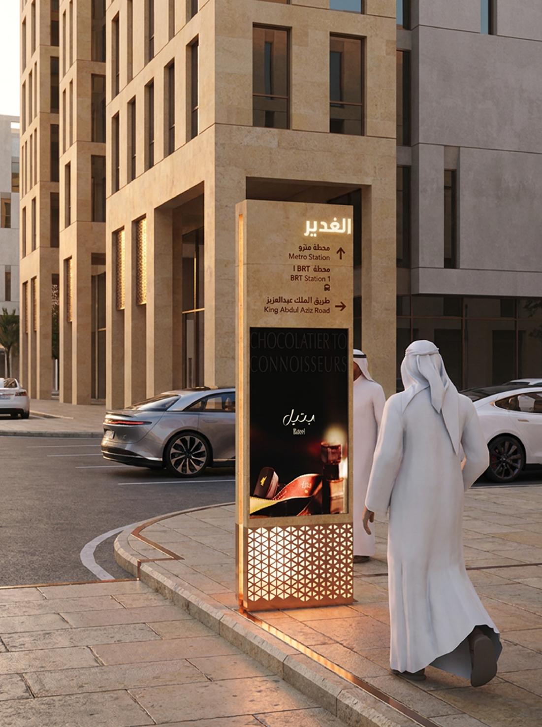
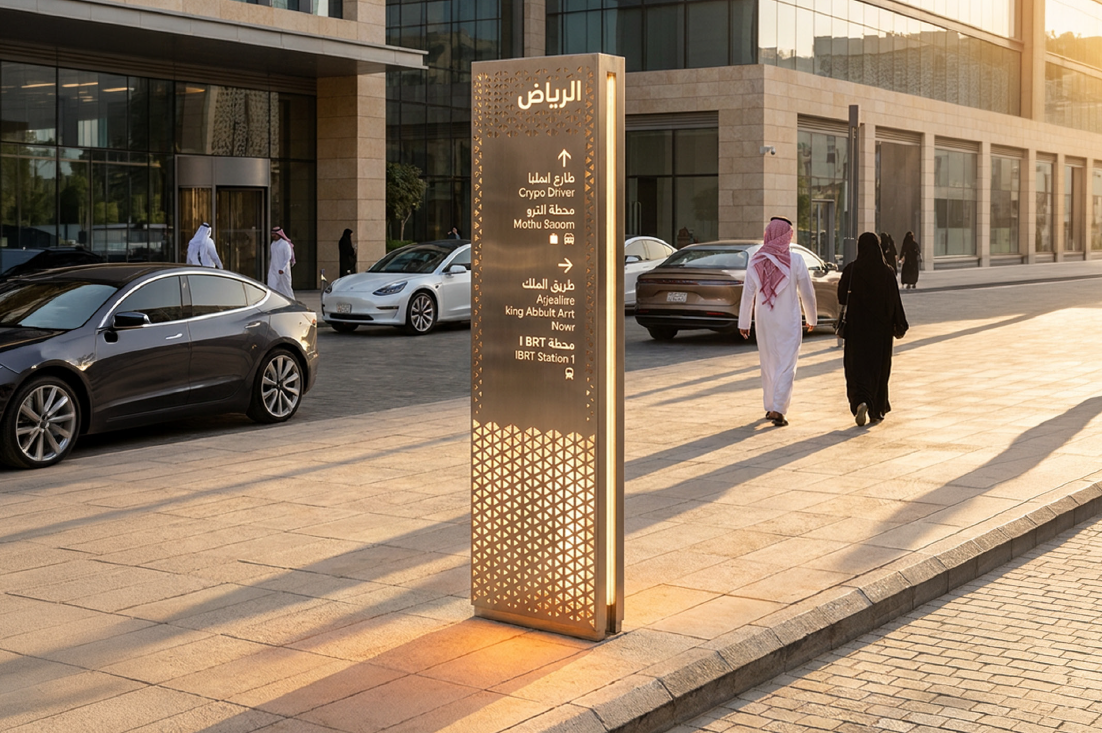
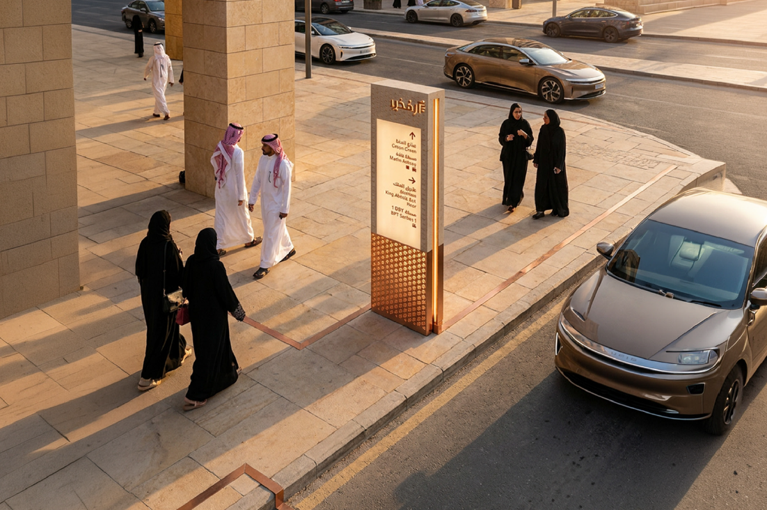
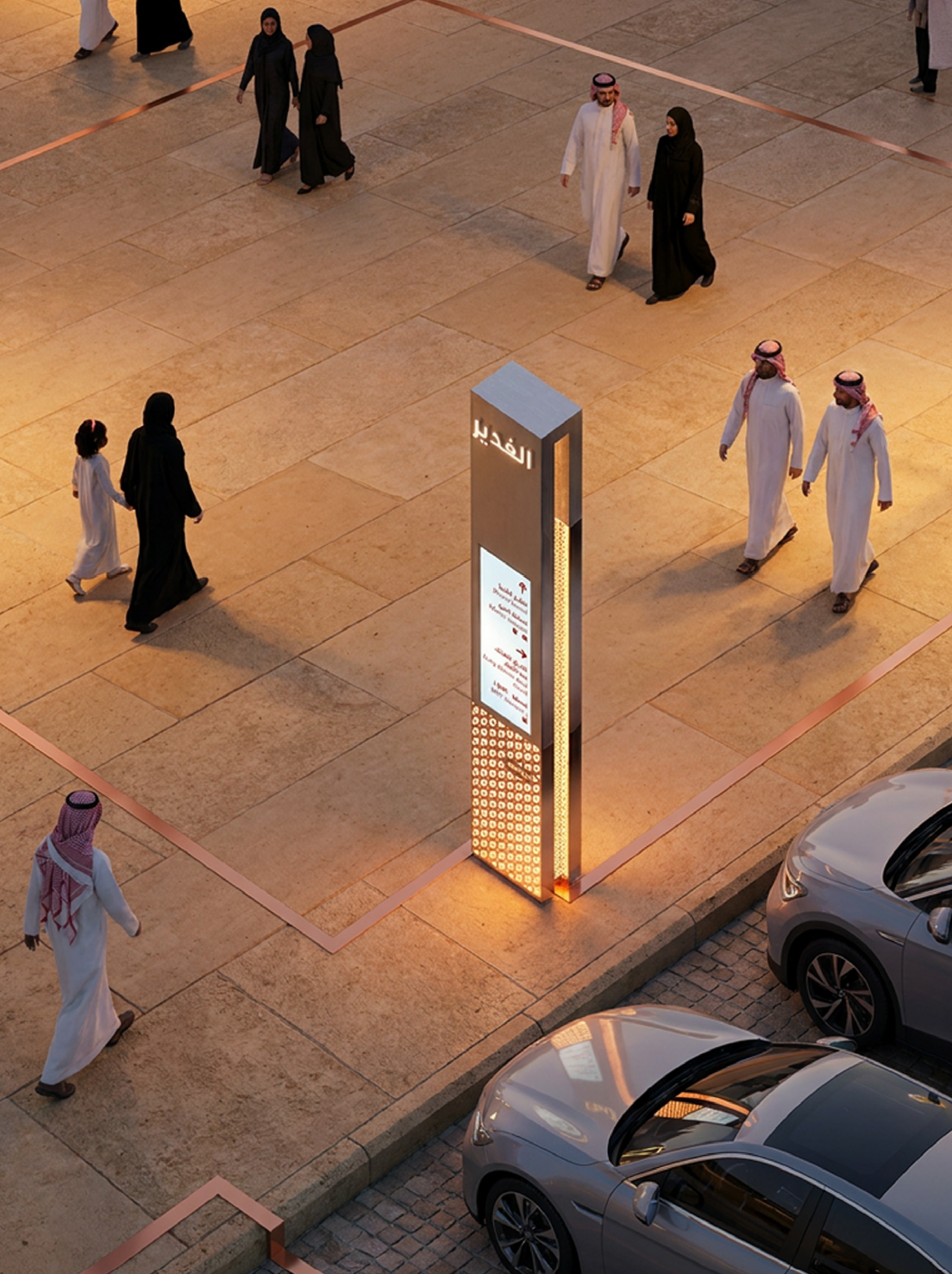
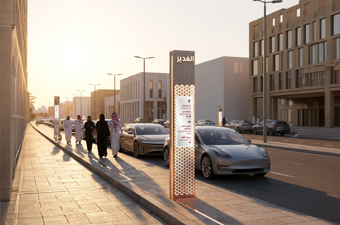
Freestanding Totem - Digital/Static
The digital freestanding totem will primarily be used at important public spaces where people can be expected to be congregate. Information will include directionals towards local points of interest and walking maps, and digital event listing and directories.
Freestanding Totem - Small

Freestanding Totem - Details

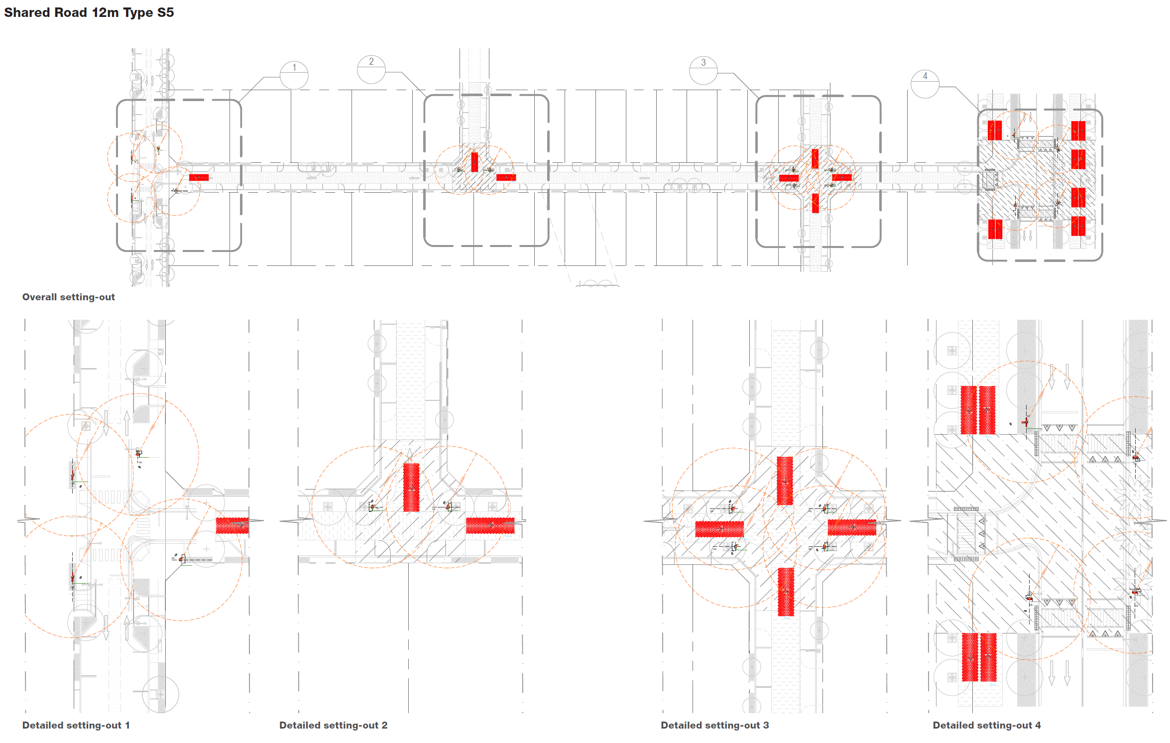
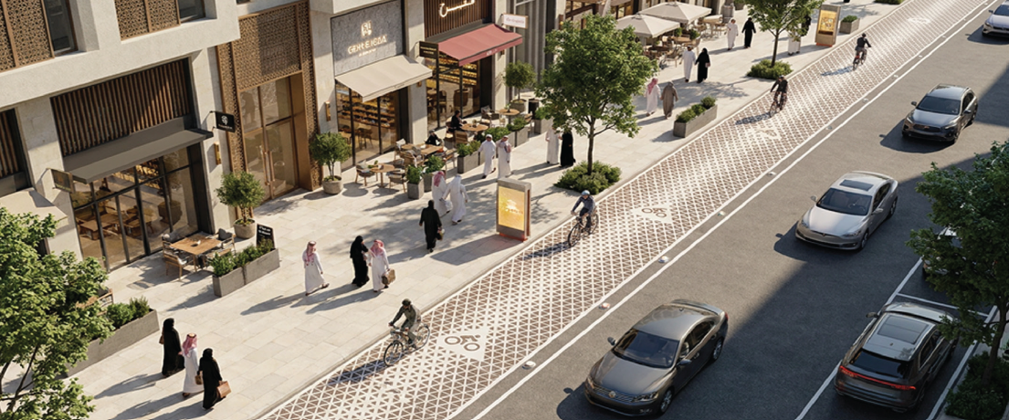
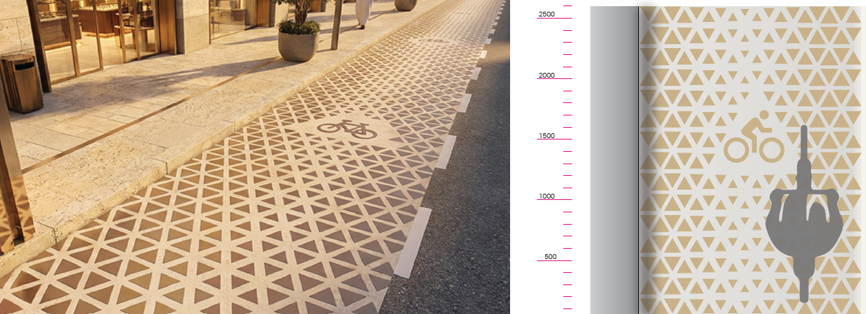
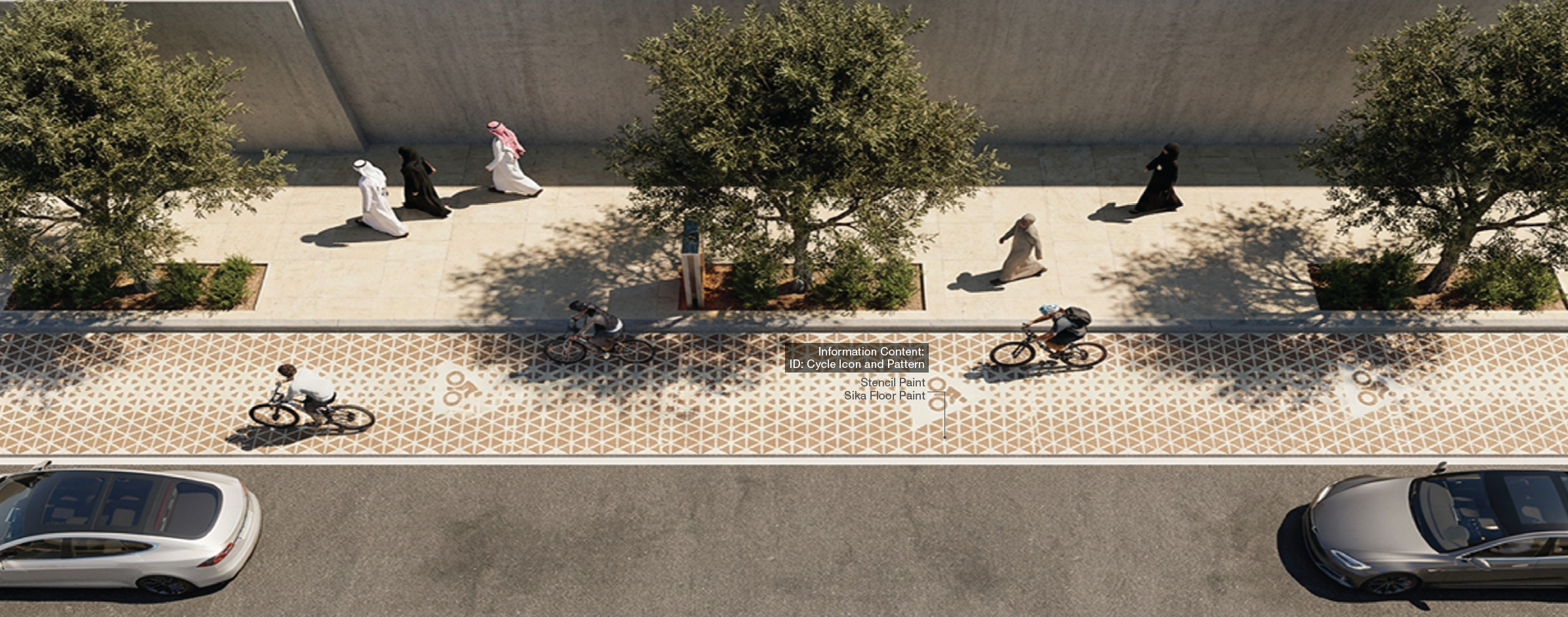
Cycle Lane
The cycle land graphics will be used consistently along all cycle lanes to denote reserved cycle space and cycling stations.
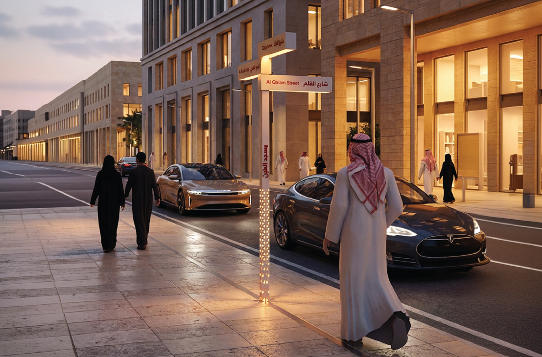
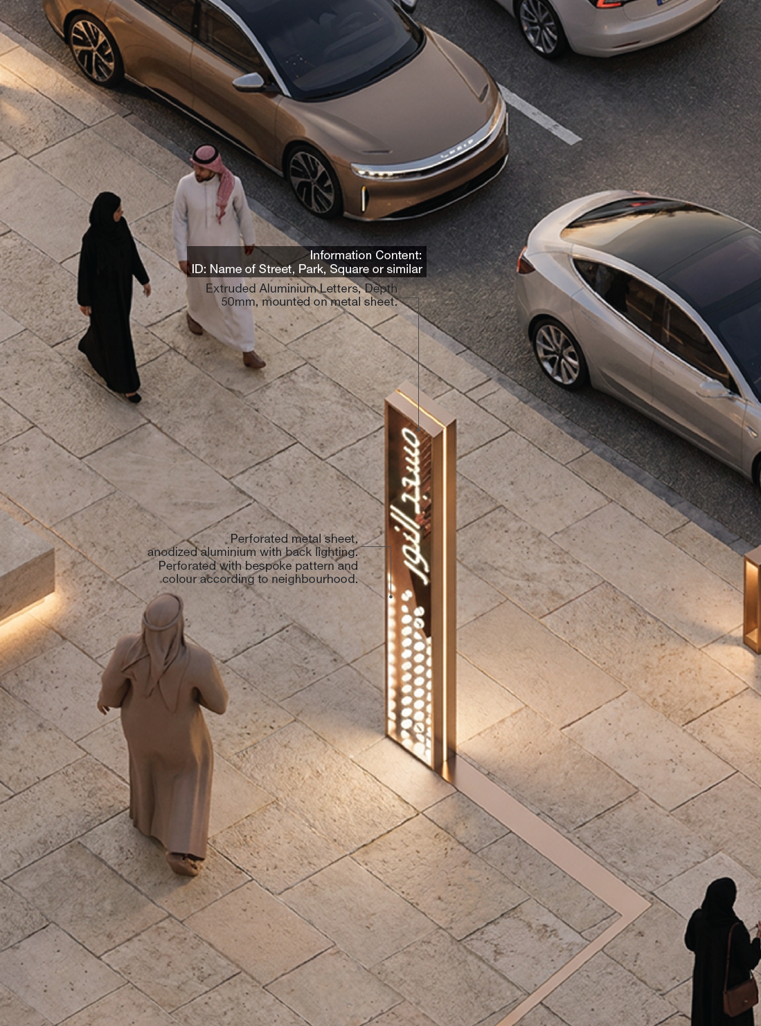
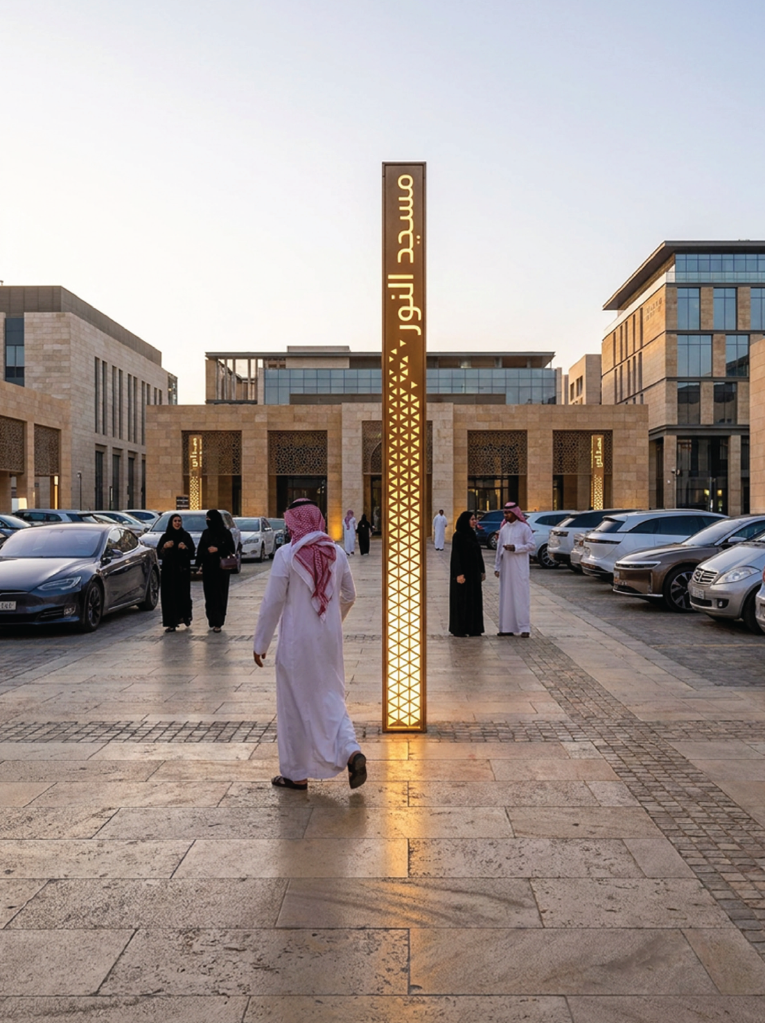
Endpoint Identifier Large/Small
The Freestanding Endpoint ID will be used to identify minor features, such as specific car parks, bicycle parking stations, small playgrounds and similar endpoints. Total Height: approx. 2.6m

Large
Small
